Seoul Mountains Part 3: Gwanaksan, Achasan & Ansan — The Hikes Most Visitors Never Find
The first two parts of this series covered the mountains that most visitors to Seoul eventually find their way to — the inner ring peaks of Part One with their fortress walls and night views, and the serious granite summits of Bukhansan and Dobongsan in Part Two. This final chapter is about the mountains that most people walk right past.
Not because they’re difficult to reach. Not because they’re hidden in any literal sense — all three are accessible by subway from central Seoul in under an hour. But because they sit outside the standard narrative of Seoul hiking, recommended less frequently in travel guides, mentioned less often by the Koreans who tend to cluster at the more famous peaks on weekends. The people who do find them tend to return repeatedly, and with good reason.
Gwanaksan anchors the southern edge of Seoul with a cliff-top hermitage and a summit that most visitors to the city never see. Achasan runs along the eastern boundary of the city above the Han River, delivering outstanding river views for modest effort. Ansan, directly west of central Seoul near Sinchon, offers a completely barrier-free circular forest walk that is unlike any other hiking experience the city has to offer.
Together, these three mountains complete a picture of Seoul as a hiking city — one that covers every level of ambition, every type of terrain, and every type of experience a walker or hiker might be looking for.
Gwanaksan — The Mountain That Surprises
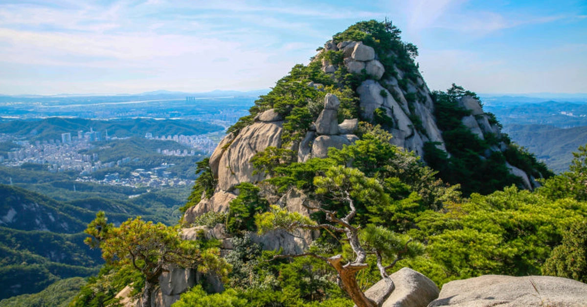
Gwanaksan sits at 632 meters on the southern boundary of Seoul, the highest of the four outer mountains that once defined the external limits of the old capital. It is home to Seoul National University, one of Korea’s most prestigious institutions, whose campus occupies the mountain’s lower slopes and whose students have been using Gwanaksan as a hiking and escape destination for generations. In autumn, the mountain’s forested slopes are among the most reliably beautiful in the Seoul area. In summer, the streams and valleys that cut through the lower elevations provide the kind of cool shade that becomes genuinely precious when the city heat builds.
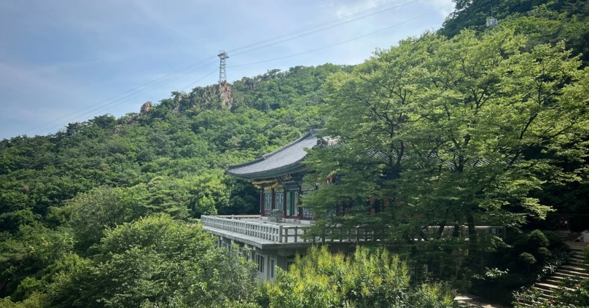
What makes Gwanaksan worth a dedicated visit beyond its natural qualities is Yeonjudae — a Buddhist hermitage that sits, by any reasonable measure, in one of the most dramatically positioned locations of any religious structure in Korea. The hermitage is perched on a sheer cliff face near the summit, built directly into the rock in a way that requires the building to be part of the mountain rather than simply on top of it. From the approach trail, the sight of the wooden halls and tile rooftops emerging from the granite face below the summit ridge produces a moment of genuine surprise regardless of how many photographs you may have seen in advance.
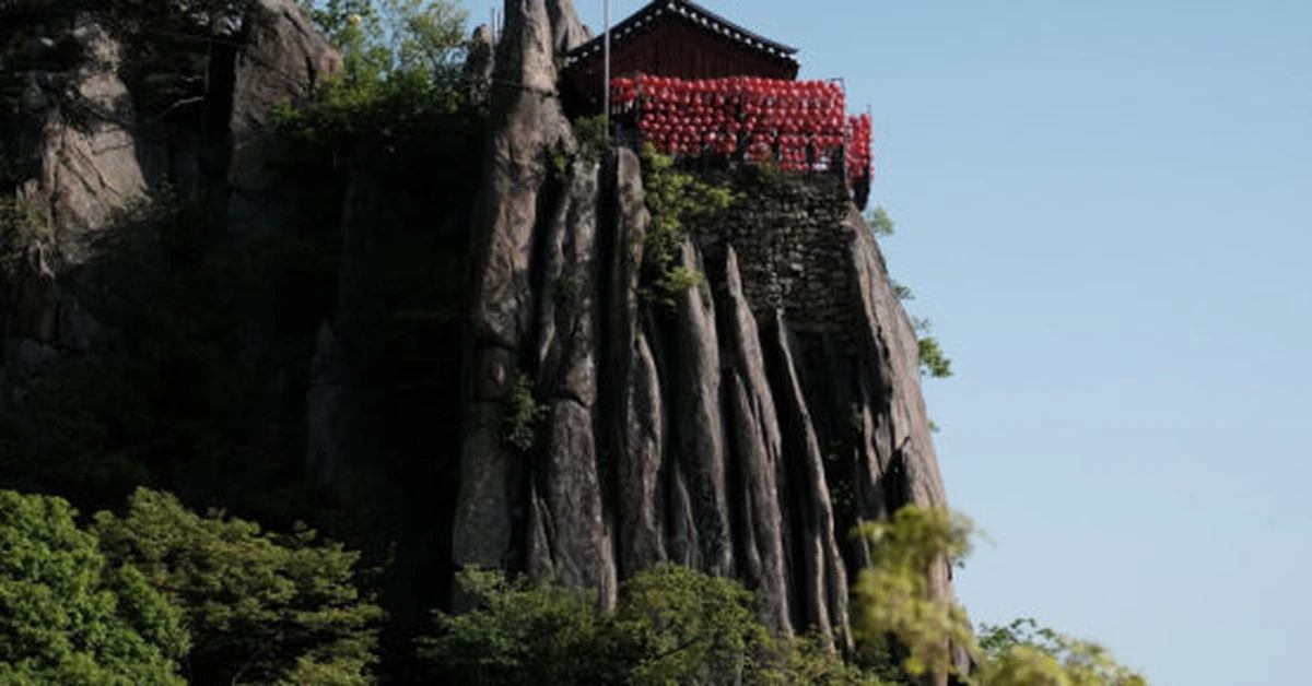
The temple itself, Yeonjuam, is small and actively used by monks. The view from the rocky platform in front of it — looking north across the full spread of southern Seoul, the Han River visible as a broad silver line in the middle distance, the Gangnam skyline rising to the left and the lower hills of the city spreading right — is one of the more memorable viewpoints available from any Seoul mountain. The combination of vertical granite, ancient wooden architecture, and that panorama makes this specific spot one of the stronger arguments for making the effort to hike Gwanaksan specifically rather than defaulting to one of the more famous peaks.
Getting There and Trail Options
Gwanaksan has three main trailhead approaches, each suited to a different kind of hiker.
The most popular and accessible route begins from Seoul National University’s main entrance. From Nakseongdae Station on Line 2, take Bus 5511 or 5513 to reach the university entrance, then follow the trail signs from building 316 into the mountain. This route ascends gradually through forested terrain, offering a moderate climb that most hikers of average fitness can manage comfortably. The round trip typically takes three to four hours at a relaxed pace.
For a quieter and more scenic approach with a different character, the Gwacheon trailhead — reached from Gwacheon Station on Line 4, Exit 7 — offers a less crowded ascent on the southern side of the mountain. This route passes through old growth forest and historic sites including a Confucian academy, and the atmosphere tends to be calmer than the university-side approach on weekends.
The Sadang trailhead, accessible from Sadang Station on Lines 2 and 4, Exit 4, is the most challenging approach. The ascent from this side involves steeper terrain and some technical scrambling sections, and the views of the city it rewards along the way are among the best on the mountain. This is the route for experienced hikers who want to be reminded they’re on a real mountain rather than a forest park.
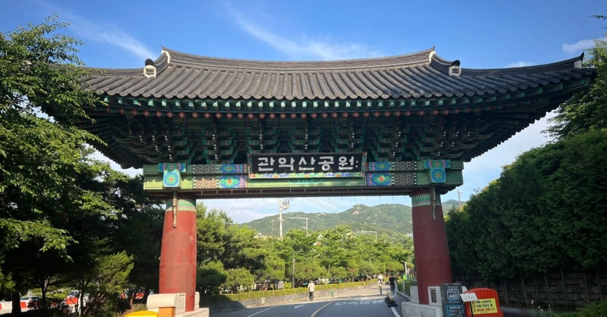
A Seoul Hiking Tourism Center is located directly within Gwanaksan Station on the Sillim Line, providing equipment rental, English-language trail information, and guidebooks covering not just Gwanaksan but other Seoul mountains as well. This makes Gwanaksan one of the more practically supported mountains in the city for international visitors.
What to Expect on the Trail
The forest on Gwanaksan is mature and dense by Seoul mountain standards, which means the lower trails feel genuinely enclosed in a way that Bukhansan’s more open ridges don’t. The sound of the city disappears quickly once you’re past the university perimeter, and the combination of deciduous and pine forest creates shade conditions that make the mountain significantly more comfortable in summer than more exposed peaks.
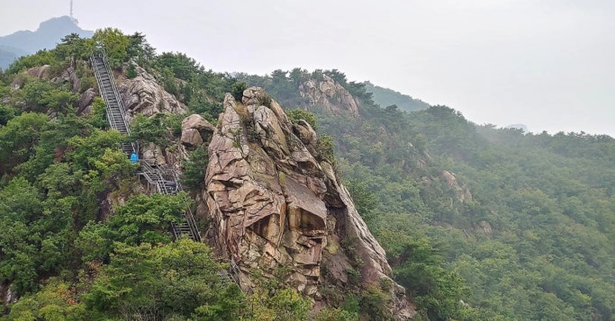
The upper sections become rockier and more demanding as the trail approaches the Yeonjudae area. Fixed iron chains and handrails assist the steeper passages near the summit ridge, but the approach is manageable for hikers who are reasonably fit and wearing appropriate footwear. The reward for the upper scramble — the hermitage appearing from the rock face below the summit — is one of those mountain moments that justifies the effort in a way that a photograph cannot fully capture.
The summit itself sits just above Yeonjudae at 632 meters. The view from the top is comprehensive — looking north across Seoul in a direction that shows the city at a scale and depth that the more northern mountains don’t quite replicate, because you’re seeing it from the south and looking all the way to the mountains beyond the northern boundary. On clear days, Bukhansan’s granite peaks are visible on the far northern horizon, with the entire city between you and them.
Practical details: Free entry. Multiple trailheads accessible by subway and bus. Hiking equipment rental at the Seoul Hiking Tourism Center at Gwanaksan Station. Round trip approximately three to four hours on the standard route, longer on the Sadang approach. Real hiking shoes required — the upper sections involve technical ground.
Achasan — The Ridge That Earns Its Reputation
Achasan is the mountain this series has been building toward recommending to the widest possible range of visitors. At 287 meters above sea level, it requires no special fitness level, no technical gear, no navigation skills, and no more than two to three hours of your day. What it delivers — consistently, regardless of season or time of day — is one of the best views of the Han River available from any elevated point in Seoul.
The mountain runs along the eastern boundary of the city, separating Seoul from the neighboring city of Guri in Gyeonggi Province. Its ridge, which the entire area is named after, extends northward toward Yongmasan at 348 meters — the true high point of the massif, though Achasan is the name that covers the whole system colloquially and the peak that most hikers use as their stated destination.
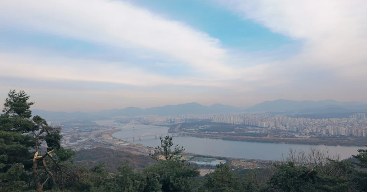
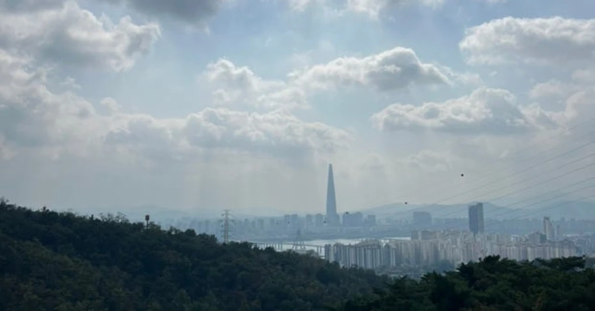
What makes Achasan’s view distinctive is geometry. From the ridge, multiple Han River bridges appear simultaneously in the frame — an alignment that few other elevated positions in Seoul can match. The water between the bridges reflects city light in the evening in a way that produces one of Seoul’s most photographed riverside panoramas. Lotte World Tower rises prominently in the southeast. Gwanaksan is visible as a distant summit in the southwest. Namsan’s tower is visible on clear days. The breadth of the view from a mountain this low and this accessible is disproportionate to the effort required to reach it, which is precisely why people who know about Achasan tend to return to it again and again.
The Ridge and Its Archaeology
Beyond the river views, Achasan offers something that most Seoul mountains don’t: visible ancient history directly on the trail. The ridge is dotted with the remnants of Goguryeo-era fortifications — earthworks and stone walls from the ancient Korean kingdom that controlled this area between roughly the 1st century BCE and the 7th century CE. Most of these structures are modest — low sections of stone wall, the footprint of a watchtower, raised platforms where sentries would have stood — but walking past them while looking out over the Han River below gives the landscape a depth of time that ordinary mountain scenery doesn’t carry.
The Goguryeojeong pavilion, reached about fifteen to twenty minutes from the trailhead, is the first major stop on the ridge and marks the beginning of the good views. Five minutes above the pavilion, a viewpoint with wooden decks and binoculars opens the full river panorama. This spot alone — the view, the forts, the river below — is worth the entire visit. Beyond it, the trail continues northward along the ridge for as long as energy and interest allow, with more fortress sites appearing at regular intervals and the views varying pleasantly with direction and elevation.
Getting There
The most direct approach is from Achasan Station on Line 5, Exit 2. From the exit, walk east for approximately five minutes to reach the trailhead — the path is clearly marked with blue signs in both Korean and English from the station, making this one of the most straightforwardly navigable mountain starts in Seoul. The main viewpoint is reachable in around thirty to forty-five minutes from the trailhead at a comfortable walking pace.
An alternative starting point is Gwangnaru Station on Line 5, Exit 1, which extends the approach slightly but adds a pleasant residential neighborhood walk before the trail begins. The full ridge traverse from Gwangnaru to Achasan Station, or the reverse, covers approximately six kilometers and takes two to three hours including rest stops.
Achasan at Sunrise and Sunset
The mountain has two particularly special time windows that experienced Seoul hikers talk about specifically.
Sunrise from Achasan ridge — particularly the viewpoint above the Goguryeojeong pavilion — is one of the best in the city. The eastern orientation of the view means the sun rises directly into your field of vision over the Guri hills, and the initial light on the Han River, before the city below has fully woken, produces a quality of stillness and color that the same spot at midday doesn’t approach. The trail from Achasan Station is short enough that arriving at the viewpoint precisely at sunrise is genuinely achievable without a predawn expedition.
The sunset view, looking west across the river as the light drops, is the one that attracts evening hikers. Lotte World Tower illuminates early, and the bridges across the Han begin to light up before the sky is fully dark, which creates the layered view — lit water, lit bridges, lit tower, darkening sky — that the best Achasan photographs tend to capture. The trail is not lit after dark, so a headlamp or phone flashlight is necessary for the descent. The trail is dominated by staircases in the steep sections, which makes descending safely in low light manageable as long as you’re paying attention.
Practical details: Free entry, open at all hours. Subway Line 5 to Achasan Station, Exit 2. No specialist gear required — the trail is manageable in athletic shoes. Round trip approximately two to three hours. Combination with Yongmasan possible for those wanting a longer day.
Ansan — Seoul’s Most Welcoming Mountain
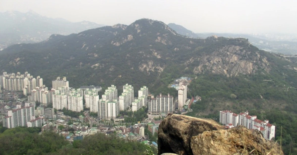
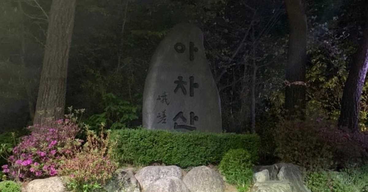
The final mountain in this series is also the one most different from everything that came before it. Ansan, rising to 295 meters near the Sinchon and Seodaemun neighborhoods in northwestern Seoul, is the city’s most genuinely inclusive mountain — a place where the experience of being in a Seoul forest is available to people who cannot or do not wish to engage with steep trails, technical terrain, or significant elevation gain.
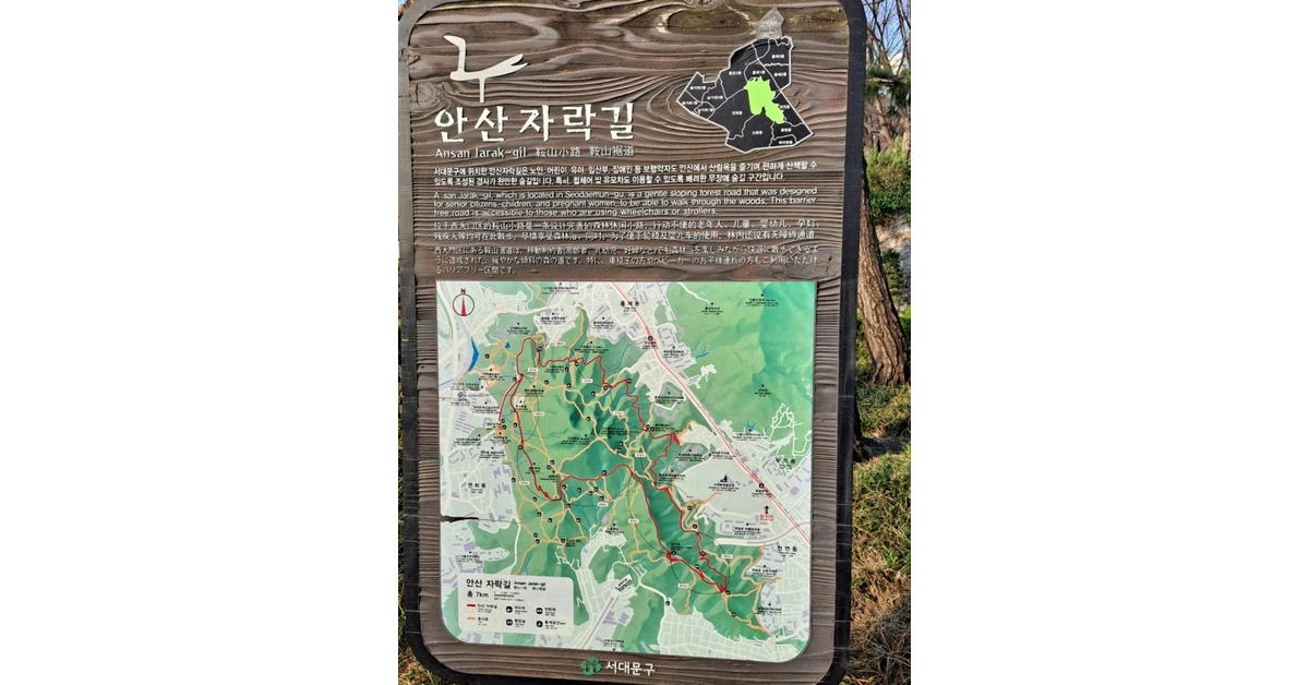
The defining feature of Ansan is the Jarak-gil — a seven-kilometer circular wooden boardwalk that circles the mountain at a gentle, consistent elevation, maintaining a gradient of less than eight percent throughout its entire length. It was the first circular barrier-free mountain trail built in Korea, and it remains one of the most thoughtfully designed pieces of urban outdoor infrastructure in Seoul. The boardwalk is fully accessible to wheelchairs and strollers. It can be walked comfortably in sneakers. It requires no navigation decisions — the circuit simply loops around the mountain and returns to where it started.
What makes the Jarak-gil more than just an accessible path is the forest it passes through. The trees on Ansan — acacia, metasequoia, and spruce among them — form a canopy that changes character as the seasons progress in a way that makes the same route feel genuinely different across the year. The spring smell of acacia flowers is one of the more underappreciated seasonal scents in Seoul. The metasequoia corridor in autumn, when the tall conical trees turn deep amber and rust, is one of the prettiest walking environments in the city. In winter, the bare branches and occasional snow create a stillness that makes the forest feel unusually large and quiet for something so close to the urban center.
The View from Ansan
The mountain’s position adjacent to Inwangsan, which was covered in Part One of this series, gives the Jarak-gil a relationship to the Seoul Fortress Wall that no other walking route in the city quite replicates. From several points on the boardwalk, the illuminated wall on Inwangsan’s ridge is visible in the middle distance — the ancient stone lit from below, glowing against the night or catching afternoon light depending on the time of visit. The combination of modern wooden boardwalk, ancient city wall, and surrounding cityscape visible through the trees is one of those Seoul moments that resist clean categorization but stay with you precisely because they combine things that shouldn’t quite go together and do anyway.
The Han River is also visible from the higher sections of the boardwalk on clear days — a distant silver line to the south, framed by the forest on either side. This is not the dramatic close-up river view that Achasan provides; it’s a quieter, more incidental view, glimpsed through trees rather than presented from an open ridge. That understated quality suits the Ansan experience perfectly.
Getting There
From Sinchon Station on Line 2, Exit 1, walk approximately fifteen minutes northwest toward Yonsei University and then follow the signs for the Ansan Jarak-gil entrance. The boardwalk entrance is past the university campus, clearly marked. Alternatively, the mountain is accessible from Dongnimmun Station on Line 3, which places you near Independence Park at the base of the mountain’s southern approach — a route that adds historical context, as Independence Park and the Seodaemun Prison Museum sit at the mountain’s foot.
The full Jarak-gil circuit takes approximately one and a half to two hours at a relaxed pace, longer if you pause frequently at the forest viewpoints. There are benches at regular intervals, rest areas with water facilities, and enough of a sense of distance from the city sounds that the walk genuinely functions as a restorative experience rather than a transit route.
Who Ansan Is For
Ansan is the mountain this series would recommend most readily to: families with young children or strollers, older visitors who want a forest experience without difficult terrain, travelers recovering from an illness or injury, people who simply want a calm walk in the trees without having to think about footwear or fitness level, and anyone whose primary interest is in the atmosphere of a Seoul forest rather than the achievement of a summit.
None of those things make Ansan a lesser experience than the other mountains in this series. They make it a different kind of experience — one oriented toward presence rather than achievement, toward sensory engagement with the forest rather than the elevation gain that makes the granite peaks worth their effort. Seoul has mountains for every kind of visitor who might want them. Ansan is for the visitor who wants the one that meets them where they are.
Practical details: Free entry, open at all hours. Subway Line 2 to Sinchon Station, Exit 1, then a fifteen-minute walk to the trailhead. No gear required. The full Jarak-gil circuit is seven kilometers. Fully accessible to wheelchairs and strollers. Combination with Bongwonsa Buddhist Temple possible at the far end of the circuit.
The Seoul Dulle-gil — Connecting Everything
Before closing this series, one more trail deserves mention for visitors who want to understand Seoul’s mountains in a more connected way.
The Seoul Dulle-gil is a 157-kilometer trail that loops around the entire periphery of the city, divided into clearly marked segments that pass through forest, stream valleys, residential neighborhoods, and the foothills of most of the mountains covered across all three parts of this series. It is not a mountain trail in the conventional sense — most sections have minimal elevation gain — but it passes through or near Gwanaksan, Achasan, Bukhansan, Inwangsan, and several others, offering a way to connect the individual mountain experiences into a larger understanding of Seoul’s geographic shape.
The trail is divided into segments that each take two to four hours to complete, making it practical to tackle one or two sections during a stay in Seoul without committing to the full circuit. Each section is marked with consistent signage, and the combination of forest, village, and stream environments along the route makes it one of the more varied walking experiences in the city. For visitors who will be in Seoul for a week or more, picking two or three Dulle-gil segments as morning walks between the city itinerary is a reliable way to see a side of the city that most short-stay visitors never access.
Putting the Full Series Together
Looking back across the three chapters of this series, what they collectively describe is a city whose relationship with its mountains is deeper, more diverse, and more accessible than almost any other major urban center in the world.
Part One covered the inner mountains that carry the city’s history in their stones — Namsan, Inwangsan, and Naksan, each offering the Seoul Fortress Wall and views that make the city’s structure legible in a way that street-level exploration never quite does.
Part Two covered the mountains that demand real effort and reward it honestly — Bukhansan and Dobongsan, where the granite summits rise above the city in a way that makes Seoul’s scale visible at once and gives the hike the particular satisfaction of proper elevation gain.
Part Three, this chapter, has covered the mountains that fit the spaces in between — Gwanaksan’s cliff-top hermitage and southern panorama, Achasan’s ridge walk and its extraordinary Han River views, and Ansan’s welcoming circular forest path that asks nothing of the visitor except the willingness to be in the trees for a while.
Together, they make the case that Seoul’s most underappreciated quality as a travel destination is the quality of what surrounds and intersects the urban fabric. The mountains are not a backdrop to the city. They are part of it — present in the view from almost every Seoul street that runs north-south, embedded in the daily habits of millions of residents who hike them before work or after dinner or on weekends with their families, and ready for any visitor patient enough to find their way to the trail that suits them.
There is, in this city, a mountain for everyone. The only question is which one to start with.
This concludes the Seoul Mountains series. Thank you for following all three chapters — if these guides helped you plan a hike in Seoul, or if you’ve already walked these trails and have your own story to share, drop it in the comments. We’d love to hear which mountain got to you.

