Seoul Mountains Part 2: Bukhansan & Dobongsan — Where the City Ends and the Real Mountains Begin
Part One of this series was about the mountains you can hike before dinner — the inner ring of peaks that rise straight from the urban fabric of Seoul and deliver city views without demanding much more than a free afternoon. This chapter is different.
Bukhansan and Dobongsan are real mountains. Not urban viewpoints with trails, not hills with good angles on the skyline — real mountains with granite summits, significant elevation gain, sections of trail that require your hands, and the particular silence that only arrives when you are high enough above the city to hear it properly.
Bukhansan rises to 836.5 meters at its highest point on Baegundae Peak. That is 280 meters higher than the Lotte World Tower, which on a clear day is visible from the summit as a small vertical mark among the vast horizontal spread of the city below. Dobongsan, sitting in the northern reaches of the same national park, tops out at 740 meters at Jaunbong Peak, and though slightly lower it earns its reputation as the more dramatic mountain — more exposed ridgelines, more technically demanding sections, and an atmosphere that feels wilder than anything you’d expect from a mountain accessible by subway.
Both peaks require a genuine day out. Pack food. Bring more water than seems necessary. Start early. Wear real hiking shoes. And clear your schedule for the evening, because your legs will remind you of the climb long after you’re back on flat ground.
Bukhansan National Park — What You’re Getting Into

Before choosing a specific trail, it helps to understand the scale of what Bukhansan National Park actually is.
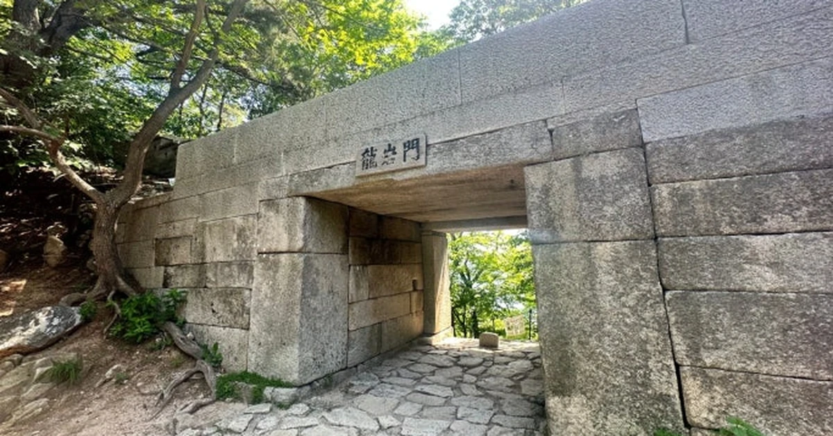
The park covers approximately 80 square kilometers across the northern edge of Seoul, straddling the boundary between the city and Gyeonggi Province. Within that area sit dozens of granite peaks, numerous Buddhist temples, the remnants of Bukhansanseong Fortress — a seventeenth-century stone fortification that once served as the emergency refuge of the royal court — and a network of trails complex enough that park rangers strongly recommend picking up a physical trail map at the information center before setting out.
The park is also, on weekends, genuinely busy. Hiking is deeply embedded in Korean culture, and Bukhansan is the closest serious mountain to the country’s largest city. On a clear Saturday in autumn, the approach paths to popular peaks can look more like crowded escalators than mountain trails. This is not an exaggeration — photographs of weekend Baegundae queues circulate online regularly, usually accompanied by expressions of genuine disbelief from people who expected a quiet mountain experience.
The practical solution is simple: hike on weekdays. The difference in atmosphere between a weekday morning and a Saturday afternoon at Bukhansan is so significant that it almost feels like two different mountains. Get there early on a weekday and you’ll have trails largely to yourself, at least for the first hour or two. Arrive on a weekend afternoon and you may be waiting in a literal queue for the final scramble to the summit.
With that context established, here is what each of the two mountains offers and how to approach them.
Bukhansan — The Summit That Puts Seoul in Perspective
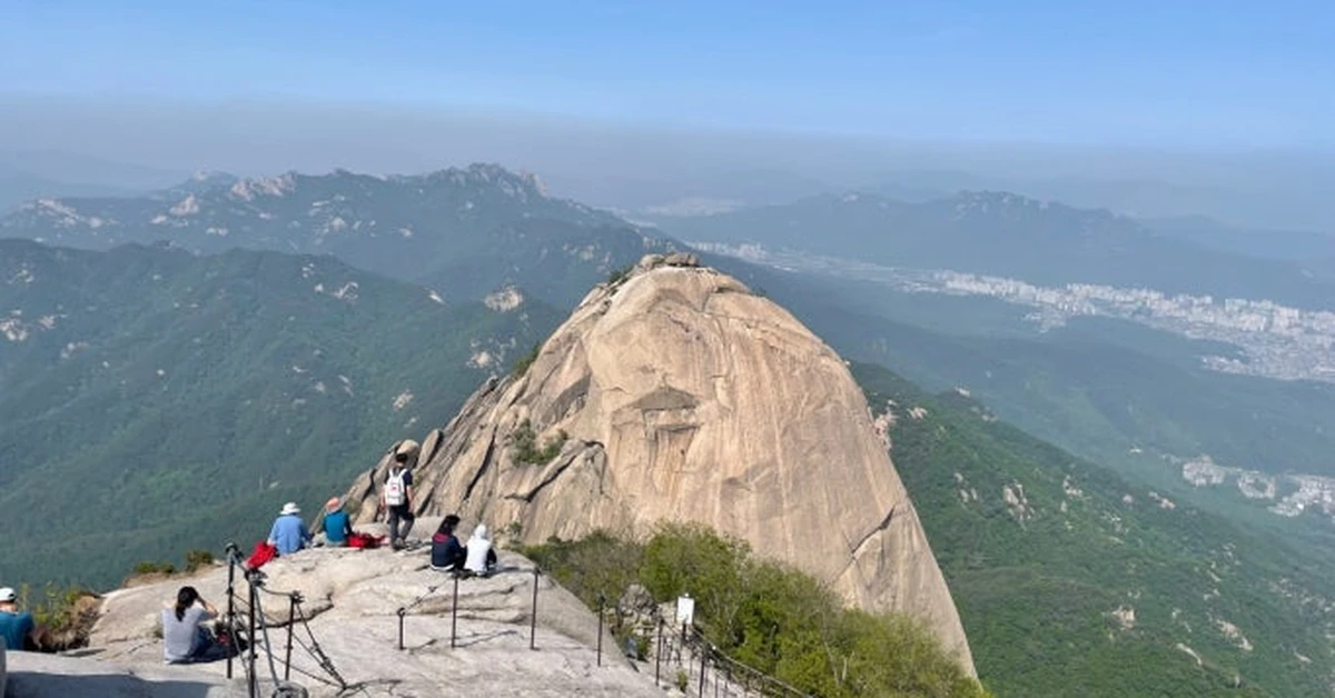
Standing on Baegundae Peak at 836.5 meters and looking south, the full scale of Seoul becomes visible in a way that no other viewpoint in or around the city can quite replicate. The city spreads from below your feet all the way to the Han River and beyond, a continuous carpet of buildings, roads, and infrastructure that stretches further in every direction than the eye can easily follow. On a clear day the Han River itself is visible as a silver ribbon curving through the southern half of the city. Lotte World Tower rises above the Gangnam skyline. Namsan, from up here, looks like a pleasant hill.
Getting to that view requires real effort, and the trail earns it.
The Bukhansanseong Course — The Main Route
The most popular and accessible route to Baegundae Peak starts from the Bukhansanseong Park Information Center, which functions as the main entrance to the fortress and valley approach. This trailhead is reached by taking Line 3 to Gupabal Station, Exit 1, then boarding Bus 704, 34, or 8772 toward the Bukhansanseong Fortress Entrance stop — a bus ride of about twenty minutes followed by a short walk to the information center.
The trail begins gently. The first section moves through a broad valley where the path is wide, paved in places, and shaded by deciduous trees whose canopy provides substantial relief in summer. Streams run alongside the path in the lower sections, and the sound of water is one of the more peaceful aspects of the early ascent. Several Buddhist temples appear along this approach — most significantly Bukhansanseong Fortress’s eastern temple complex and the smaller hermitages tucked into the hillside above — and these are worth pausing at rather than hurrying past. The temples carry the weight of the mountain’s history in a way that trail signs can’t quite communicate.
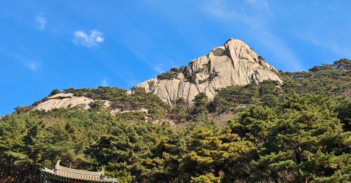
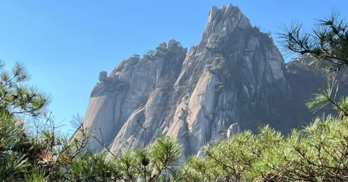
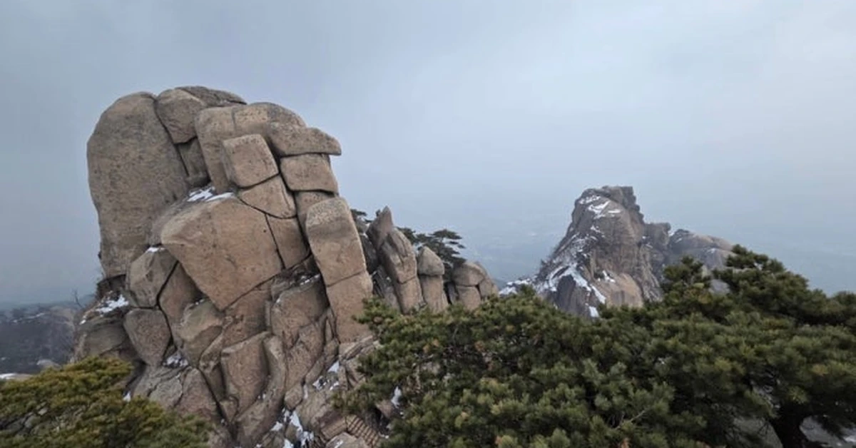
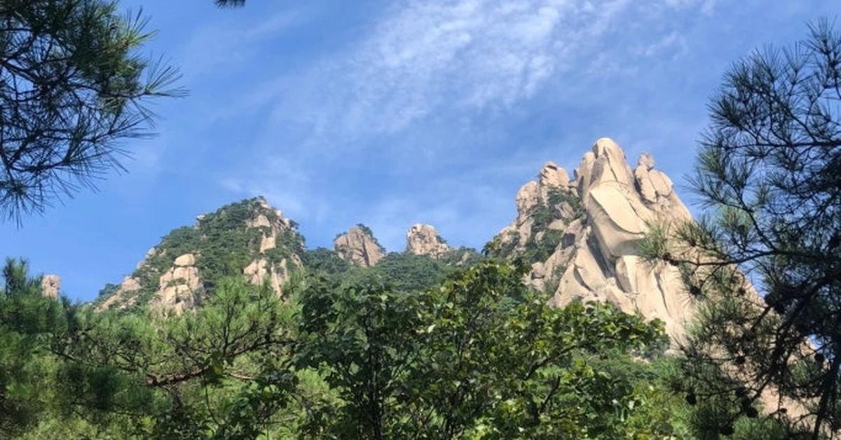
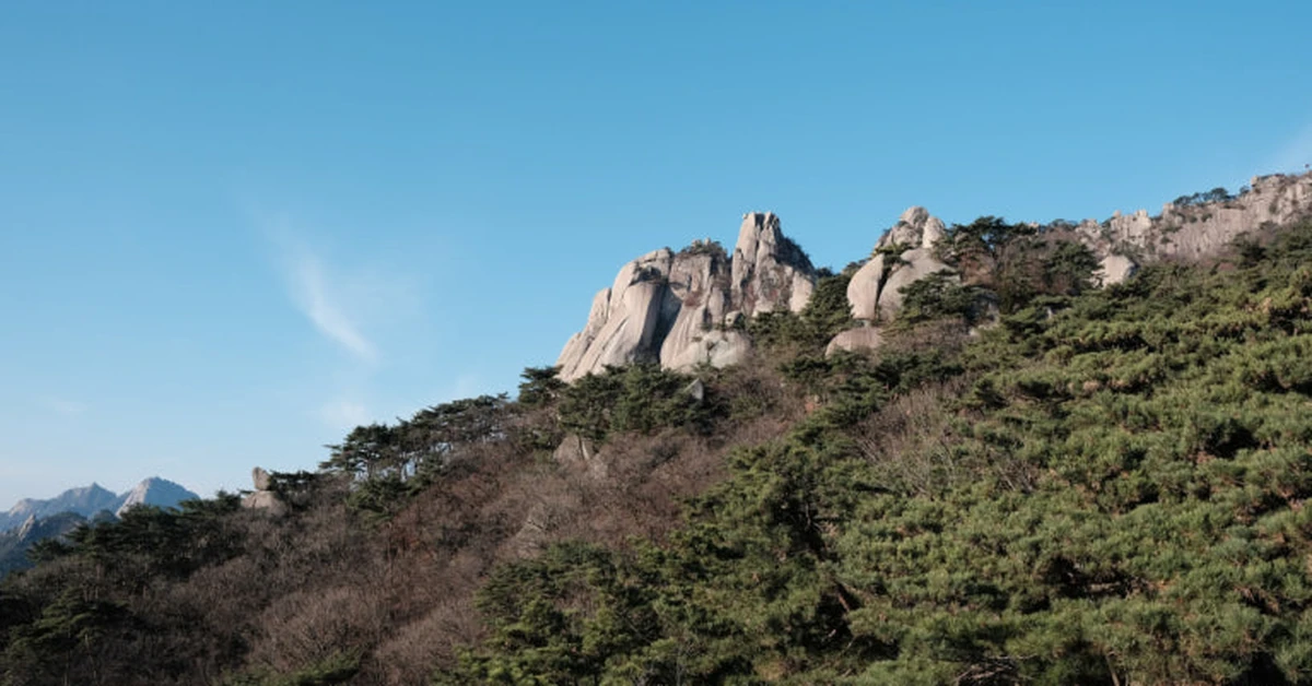
After roughly ninety minutes of moderate walking, the trail changes character. The paved sections end, the incline steepens sharply, and the granite begins to emerge from the forest floor. Stone steps give way to sections of open rockface where iron handrails and fixed chains have been installed to assist the ascent. This final approach to Baegundae is physically demanding and requires the use of both hands at certain points. The exposure increases with elevation, and the view that opens up below you as you climb the final granite dome is part of what makes the summit arrival feel genuinely earned rather than merely achieved.
The summit itself is a broad, angled slab of granite at 836.5 meters, offering an unobstructed 360-degree panorama. Koreans who have been hiking this mountain for years typically arrive with full picnic setups — rice, kimchi, sometimes proper ramen cooked on a portable stove — and settle in at the top with the kind of calm competence that speaks to a long and comfortable relationship with mountains. It’s a reminder that Korean hiking culture is something specific and admirable: not a checklist to be completed, but a practice to be returned to, season after season, with proper preparation and genuine enjoyment.
The round trip on the Bukhansanseong Course covers approximately 8.4 kilometers with a total elevation gain of around 745 meters. Allow five to six hours for the full return at a comfortable pace, more if you plan to explore the fortress walls or temples along the way.
The Doseonsa Temple Route — An Alternative Approach

For visitors who want to experience Bukhansan without quite as much elevation gain, the approach via Doseonsa Temple on the eastern flank of the mountain offers a different character. Doseonsa is one of the oldest temples in the park — founded over 1,100 years ago — and the approach road to the temple can be reached by road, which means starting the hike from a higher base elevation.
From Doseonsa, the trail climbs through mature pine forest with a more consistent gradient than the Bukhansanseong approach, and the atmosphere around the temple grounds — the smell of incense, the sound of ceremony bells, the particular stillness of a working religious site in a mountain setting — is one of the more distinctive experiences the park offers. The summit is accessible from this direction in approximately two to three hours of hiking depending on pace and route choice.
Insubong Peak — For Those Who Want More
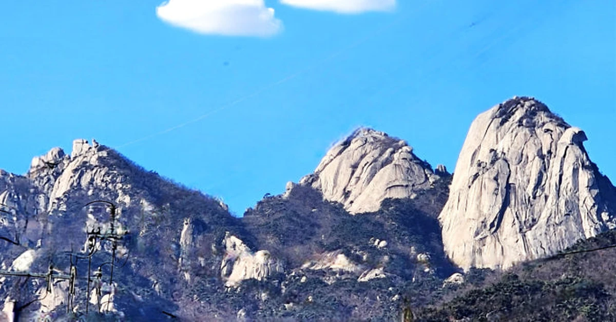
If Baegundae is the summit that most hikers aim for, Insubong is the one they look at from the trail and feel a different kind of pull toward. This 810-meter granite spire rises sharply from the forest — a sheer, dome-shaped rock face that is visible from almost every approach to Bukhansan and looks, from a distance, almost impossibly vertical.
It is not accessible by the standard hiking trails. Insubong is a rock climbing peak, and ascending it requires proper equipment, technical knowledge, and ideally a guide or an experienced partner. The base of the peak, however, is easily reached on foot, and spending time there watching climbers navigate the face provides a perspective on the mountain that the forested trails don’t offer. The scale of the granite, this close to the city, is genuinely awe-inspiring.
Dobongsan — The Wilder Mountain
Dobongsan sits in the northeastern sector of Bukhansan National Park, accessible from Dobongsan Station on Lines 1 and 7. The station’s exit places you directly at the beginning of a vibrant commercial strip that exists entirely to serve the mountain: hiking gear shops, makgeolli vendors, restaurants selling pajeon and acorn jelly and grilled vegetables, all oriented toward the streams of hikers who arrive and depart throughout the day. The whole setup has a particular energy — purposeful, comfortable, and deeply Korean — that is part of the Dobongsan experience before the mountain itself even begins.
The key difference between Dobongsan and Bukhansan is character. Where Bukhansan offers a sense of gradual revelation — the mountain reveals itself in stages as elevation increases and the granite emerges from the forest — Dobongsan announces itself from the trailhead. The jagged peaks are visible immediately. The ridgelines are more exposed, the drops more dramatic, and the sense of genuine mountain rather than elevated hill more immediate.
Jaunbong Peak — The Signature Summit
The main summit of Dobongsan is Jaunbong Peak at 740 meters, with two slightly lower companions in Manjangbong at 718 meters and Seoninbong at 708 meters. The standard route to Jaunbong begins at the Dobong Park Information Center and follows the Sinseondae Course, a trail of approximately 3.3 kilometers one way that carries an official difficulty rating of advanced.
That rating is honest. The trail begins with a manageable forest approach, but the gradient increases consistently throughout, and the upper sections involve technical scrambling over exposed granite with fixed ropes and chains to assist the most demanding passages. The views from the ridge before the final summit push — looking south toward the Seoul skyline, west across the mountain terrain of the park, north toward the less populated countryside beyond the city boundary — are different from the Bukhansan summit panorama but equally compelling. Dobongsan sits slightly further from the urban center, which gives the view a sense of distance from the city that Bukhansan doesn’t quite have.
Allow approximately three hours one way for the ascent to Jaunbong, and two hours or slightly less for the return — the downhill is faster but demands more care on the exposed sections. The full round trip of around 6.3 kilometers typically takes five to six hours for most hikers at a comfortable pace.
One important note: the very summit of Jaunbong Peak has at times been restricted due to erosion and safety concerns. Check current access conditions before the visit, as the situation changes periodically. The trail up to the Sinseondae viewpoint below the summit is generally open and offers views comparable to the peak itself.
The Dobongsan Trailhead Experience
Part of what makes Dobongsan distinctive from Bukhansan is the trailhead culture. The area around Dobongsan Station has developed into what can only be described as a hiking village within the city — several hundred meters of shops and restaurants that exist for precisely one purpose, compressed into the space between the subway exit and the park entrance.
The hiking gear shops here are worth noting for practical reasons: if you arrive at Dobongsan underprepared — wrong shoes, no trekking poles, insufficient food or water — the trailhead shops can remedy almost any deficiency before you set foot on the trail. Gear quality varies but the prices are competitive and the vendors, accustomed to assessing hikers’ needs quickly, are generally helpful.
The food at the trailhead restaurants deserves specific mention. These are the places where the distinctly Korean tradition of post-hike eating is most visibly practiced. Dotori-muk, acorn jelly served cold with a soy and sesame dressing, is a Dobongsan specialty rarely found elsewhere in Seoul. Deodeokgui, grilled deodeok root with a sweet-soy glaze, is another mountain food that appears at trailhead restaurants here in a quality that puts city versions to shame. The combination of a post-hike meal at one of these restaurants and a cold draft makgeolli — Korea’s milky traditional rice wine, served in a bowl rather than a glass at mountain restaurants — is one of those pleasures that only makes sense after two thousand meters of elevation change, but makes complete sense then.
What Korean Hiking Culture Looks Like Up Close
Hiking in Korea — and particularly hiking in Bukhansan and Dobongsan — is an opportunity to observe a cultural practice that doesn’t translate well in description but is immediately recognizable in person.
Korean hikers, as a general category, are the best-equipped hikers in the world. The outdoor clothing industry in Korea is significant, and the full technical ensemble — matching jacket and trousers in coordinating colors, trekking poles with wrist straps, gaiters, proper boots, a hydration pack — is standard rather than exceptional at Seoul’s mountains. Korean hiking fashion is simultaneously functional and aesthetically considered in a way that takes a moment to register before it becomes one of the more charming aspects of the trail experience.
Beyond the equipment, the practice itself has a particular quality. Korean hikers hike with purpose but not haste. They stop frequently, not to rest exactly, but to appreciate — the view from a particular rock, the quality of light on a valley at a particular hour, the sound of a stream. They bring proper food, and they eat it properly, usually at the summit or a recognized rest point, sometimes at considerable length. There is a sociability to it — complete strangers share sections of trail in conversation, offer water or snacks, give route advice with the authority of frequent visitors — that creates an atmosphere quite different from the individualistic silence of hiking in many other cultures.
Watching a group of older Korean hikers — the so-called mountain grannies and grandpas, 산할머니 and 산할아버지, who hike these mountains in their seventies and eighties with a stamina that embarrasses far younger visitors — descend Baegundae with practiced ease while carrying full picnic setups is one of the more genuinely inspiring things Seoul has to offer. This is not metaphor. They are formidable.
Essential Practical Information
Getting to Bukhansan (Bukhansanseong trailhead) Take Line 3 to Gupabal Station, Exit 1. Board Bus 704, 34, or 8772 to the Bukhansanseong Fortress Entrance stop (approximately 20 minutes). Walk 5 minutes to the park information center. Total journey from central Seoul: approximately 50 to 70 minutes.
Getting to Dobongsan Take Line 1 or Line 7 to Dobongsan Station, Exit 1. Cross the main road and follow the crowds and signs to the park entrance. Total journey from central Seoul: approximately 40 to 60 minutes.
Gear rental The Seoul Hiking Tourism Center, located near Bukhansan Ui Station on the Ui Light Rail, offers rental of boots, trekking poles, crampons, gloves, and backpacks. All equipment is cleaned and sterilized between uses. This is a genuinely useful resource for travelers who don’t want to travel with hiking equipment but want to do a proper mountain day.
What to bring Proper hiking footwear is the single most important item — trail runners or hiking boots with ankle support and grip. The summit sections of both mountains are exposed granite, which becomes dangerously slippery in wet conditions and demands soles with real traction. Pack at minimum 1.5 liters of water per person for Baegundae, more in summer. High-calorie snacks, sunscreen, a small first aid kit, and a light wind layer for the exposed summit ridges round out the essentials.
Trekking poles Strongly recommended for both mountains, particularly for the descent. The knee load on a long granite descent is considerable, and poles reduce it significantly. Available for rent at the trailhead areas of both mountains if you don’t have your own.
Timing Both peaks close access at certain times to manage crowds and erosion. Check current access conditions with the Korea National Park Service before your visit. Weekend access to Baegundae in particular is subject to a visitor cap that can result in waiting times at the summit approach.
Seasonal Notes
Spring on Bukhansan and Dobongsan is spectacular. The azalea blooms on the lower slopes in April and early May produce dense patches of pink and red against the grey granite, and the cherry blossoms in the approach valleys arrive slightly earlier and stay slightly longer than those in the city below. The air clarity of spring, before summer humidity arrives, produces the best conditions for long-distance views from both summits.
Autumn is equally compelling, and this is the period when Korean hikers consider the mountain at its most beautiful. The deciduous forest that covers the lower and middle sections of both mountains turns comprehensively gold and red from October into early November, and the contrast between that color and the grey granite above it is one of the more reliably photogenic mountain compositions in Korea.
Summer hiking is possible but demanding. Seoul’s summer humidity does not relent at 800 meters, and the exposed granite summit sections accumulate heat that makes late-morning and midday ascents genuinely uncomfortable. Starting before 7am is the standard recommendation from regular Bukhansan summer hikers. Bring considerably more water than seems reasonable. The trade-off is that summer clouds and atmospheric haze sometimes produce extraordinary conditions at the summit — the city spread below in the valley haze with the mountain peaks emerging above it in a way that suggests scale more than any clear-day panorama can.
Winter changes the character of both mountains completely. The snow-covered granite of Baegundae, the frozen streams in the approach valleys, the ice-rimed pine trees on the ridgelines — these make for a different kind of beautiful. Winter hiking on both mountains requires crampons or clip-on ice spikes for the summit sections, as the granite becomes genuinely treacherous when iced. Equipment rental at the Seoul Hiking Tourism Center includes crampons. If in doubt, hike the lower sections and admire the peaks from below in winter.
After the Hike
A day on Bukhansan or Dobongsan typically ends with legs that have opinions about the elevation change. The most culturally appropriate response is also the most effective one: a traditional Korean jjimjilbang, or heated bathhouse, followed by whatever food is most compelling.
The jjimjilbang experience — gender-separated soaking pools at various temperatures, a communal heated floor room where people lie on mats under the radiant warmth, optional additional services ranging from massage to body scrubs — is practically designed for post-hike recovery. The heat and the soaking do things for tired muscle groups that no amount of stretching replicates. Most jjimjilbang facilities in Seoul charge between 12,000 and 20,000 won for a standard stay and are open around the clock. Planning a jjimjilbang stop for the evening after a Bukhansan day hike is one of those logistical decisions that seems optional in advance and necessary in retrospect.
Final Thoughts on Part Two
Bukhansan and Dobongsan are where Seoul stops being a city and becomes something else for a few hours — a place where the view from a granite summit makes the entire scale of the metropolis visible at once, where the silence of a mountain forest settles around you completely, and where the effort of getting there is directly proportional to the quality of what you find at the top.
This is genuinely the best day hiking available within the administrative limits of any major city in the world. Not the most dramatic — those mountains are elsewhere, further, higher. But the specific combination of accessibility, genuine terrain, and the particular beauty of seeing ten million people’s city laid out below you from a real summit is something Seoul offers and almost nowhere else does.
Go on a weekday. Start early. Bring too much water. Eat ramen at the top.
Up next — Part 3: Seoul’s Hidden Mountain Gems — Gwanaksan, Achasan, and Ansan. Three peaks that most visitors never find, and why each one is worth the detour.
Have you hiked Bukhansan or Dobongsan? Which peak did you climb, and what did the city look like from the top? Share your experience in the comments.

